Geo6HMS
Home
Tech
Creation
MapSkills
Continents and Oceans
Thematic Maps
Ch2ClassActivities
Ch2GeoTerms
Physical Features
Climate Vegetation
Population Density
EconomicActivity
Canada
GeoTerms
Regions
People
Language
SeasonalFun
EconomicActivity
Presentation
ISTE2016
>
Refreshing Geography
>
GeographyExchange
AmazonEdu
Current Events Across Curriculum
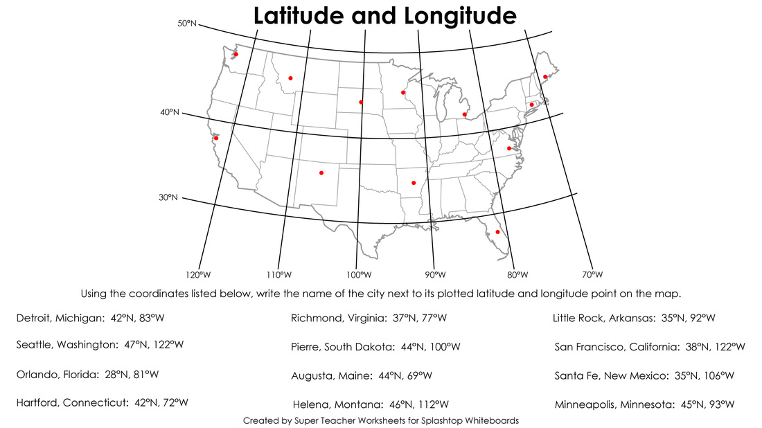
Latitude and Longitude
Resources for Location
(latitude and longitude)
Interactive AND descriptive!
http://earthguide.ucsd.edu/earthguide/diagrams/latitude_longitude/
MrNussbaum International Pizza Delivery
http://mrnussbaum.com/international-pizza-delivery-2.html
Purpose Games with dots for Latitude and Longitude
http://www.purposegames.com/game/e143227a04
Message in a Bottle Lesson
http://teacher.scholastic.com/lessonrepro/reproducibles/profbooks/MessageinBottle.pdf
ABCya! (only works with Flash)
http://www.abcya.com/latitude_and_longitude_practice.htm
Quizlet
https://quizlet.com/27659060/latitude-and-longitude-of-major-cities-flash-cards/
use with PDF map of World Cities
Quizlet for Latitude and Longitude AND Map Scale
https://quizlet.com/161862265/
Rags to Riches for important lines and continents
http://www.quia.com/rr/31012.html
Kids Discover Explanation of Latitude and Longitude
Map Hurricanes and Tropical Storms
http://weather.unisys.com/hurricane/index.php
Videos on
Flocabulary
or
BrainPOP
Flocabulary about the
Coordinate Plane
(similar to latitude and longitude)
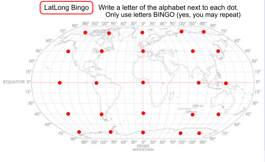
For LatLong Bingo, you need to save the digital image above
Open the image in a photo program that lets you add text (like
Skitch
).
Next to each dot, write a letter, either B I N G or O.
Save the image to your photo roll.
Open your modified image in the photo program.
Mark off the locations as they are called.